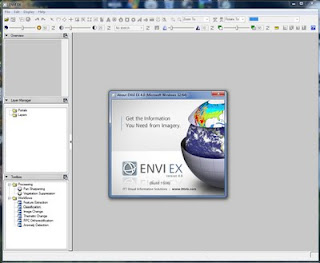
ENVI (EX) 4.8 with SARscape 4.3 | 1.8 Gb
The ENVI product family provides a variety of software solution for processing and analyzing geospatial imagery used by scientists, researchers, image analysts, and GIS professionals around the world. ENVI solutions combine the latest spectral image processing and image analysis technology with an intuitive, user-friendly interface to help you get meaningful information from imagery.
About Us
ITT Visual Information Solutions (ITT VIS), formerly known as Research Systems Inc. (RSI), provides integrated software and services that help scientists, developers, image analysts, and medical professionals turn complex data into useful information.
Our customers around the world use our products - IDL, ENVI and IAS - to analyze and deliver data and imagery, and to develop and deploy software applications.
Introducing ENVI 4.8
Regardless of your industry, from forestry and agriculture to defense and intelligence, your reliance on geospatial imagery as a source of important geographic information continues to grow. ENVI is the premier software solution for extracting information from geospatial imagery. ENVI delivers innovative, time saving ways to get information from imagery, while making it easy to incorporate image processing and analysis into your existing workflow.
Now, the latest release of ENVI delivers features and functionality to further streamline your workflow and reduce the time you spend on image processing and analysis. ENVI 4.8 makes it seamless to update a GIS with current information from geospatial imagery by delivering image analysis tools directly from the ArcGIS environment. A new, high performance LiDAR viewer allows you to easily incorporate information from LiDAR data with your other geospatial data, and a new workflow for viewshed analysis automates and streamlines a multi-step process. And, because ENVI is built on a fully extensible platform, you can easily customize it to your specific imagery needs.
More info: http://www.ittvis.com/portals/0/webinar/envi_48_release_movie_small/envi_48_release_movie_small.html
What is ENVI EX?
ENVI EX is the newest addition to the ENVI line of premier image processing and analysis software products. ENVI is the choice of imagery scientists and professionals for extracting scientifically accurate information from imagery. Now ENVI EX delivers the accurate, scientifically proven processes that ENVI is known for in revolutionary step-by-step workflows that quickly and easily guide you through advanced image processing tasks, regardless of your experience level.....more info: http://www.ittvis.com/ProductsServices/ENVI/ENVIEX.aspx
SARscape Modules for ENVI
The use of Synthetic Aperture Radar (SAR) data has become increasingly popular in recent years, offering professionals in a wide array of industries a measurable, analytical approach to getting information about an area or object of interest. SAR is a sophisticated data type, acquired from airborne and spaceborne platforms, and can produce two or three-dimensional datasets of surface areas. When combined and merged with spectral imagery, SAR provides the additional, critical layer of information you need......more info: http://www.ittvis.com/language/en-US/ProductsServices/ENVI/SARscape.aspx
Download


0 nhận xét:
Đăng nhận xét